From the prevalence of meth labs to the real size of Alaska, we look at fascinating maps that uncover the United States of America.
Years ago, famed historian E.H. Carr made an apt point that one cannot separate the historian from history and that what we see in history books is not necessarily pure fact–it has been made and presented as such due to the judgments of a very fallible and selective person.
All of this is to say that when it comes to getting to the reasons why the United States looks the way it does today, “truth”–if we can find it–is quite hard to come by.
For every historian who disputes the reasons why a certain war broke out or how a particular president’s decision changed the fate of America, there’s a map that lays hard data bare and allows for the viewer’s own interpretation.
Maps aren’t as immediately exciting as a good story, which is why we tend to overlook them when trying to understand our present. We’d like to change that. Without further ado, here are thirty-three fascinating maps that explain the United States:
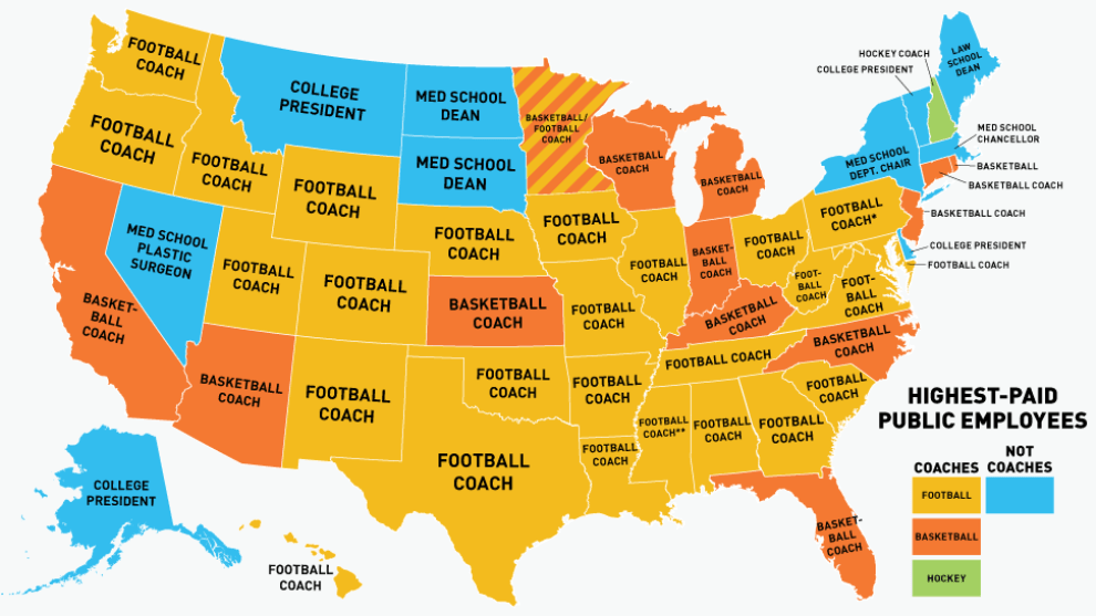
The Highest Paid Public Employees In Each State
Once additional compensation from media appearances, fundraising and apparel contracts are factored in, sports coaches are the highest-paid employees in 40 out of 50 states.
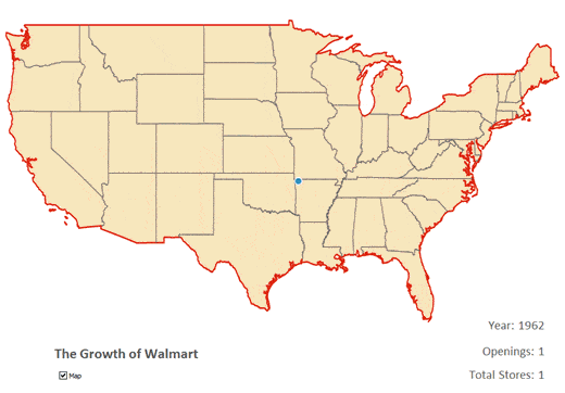
The Growth Of Walmart Animation
Founded in 1962 by Sam Walton, Walmart grew over the next fifty years from one store in Bentonville, Arkansas, to over 11,000 stores in 27 countries. Walmart is currently the world's largest company by revenue, generating 258 billion dollars in sales each year.
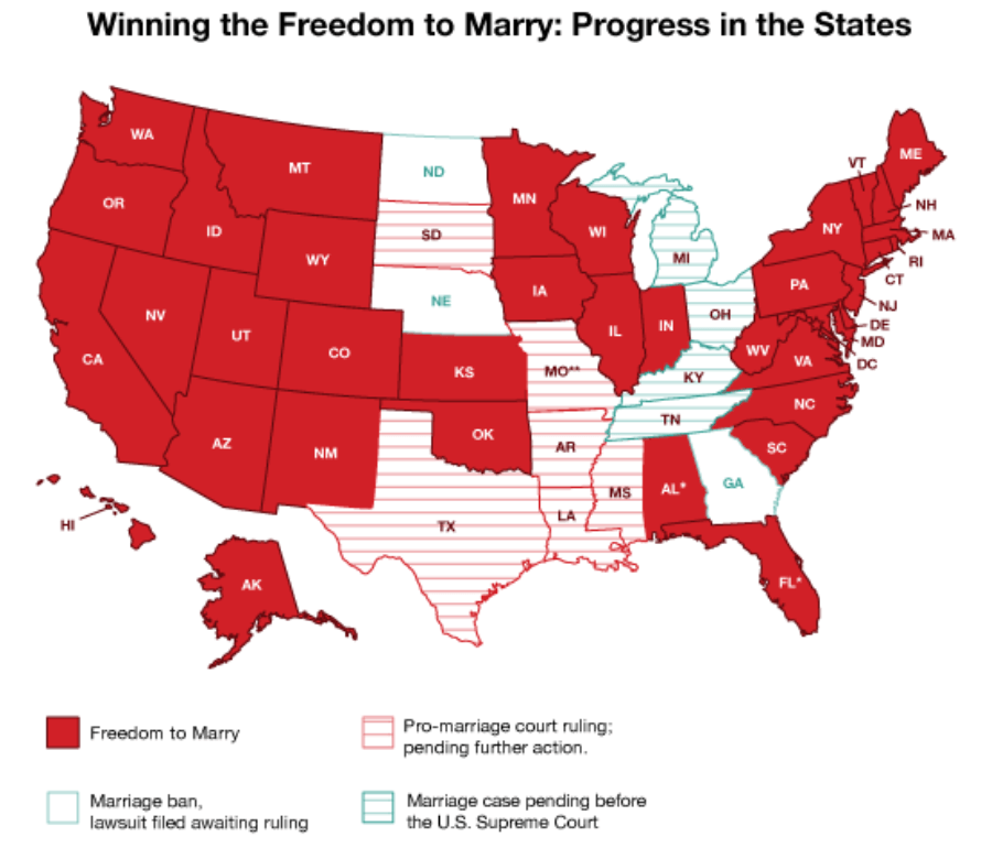
The Status Of Gay Marriage By State As Of February 2015
When the US Supreme Court struck down the Defense of Marriage Act, many activists rejoiced--gay marriage was here at last.
While they did declare DOMA unconstitutional, the Supreme Court still left the decision of permitting or banning gay marriage up to individual states. As of this writing, 37 states allow gay marriage, with groups challenging marriage restrictions in the states that haven't adopted more inclusive marriage laws.
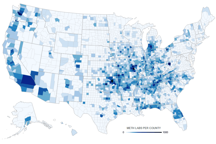
Meth Labs By County
Once a relatively obscure drug associated with biker gangs, methamphetamine has become one of the most popular drugs in America thanks to its relatively easy and cheap production. In a recent nationwide survey, one out of two hundred adults in America reported using meth in the past year.
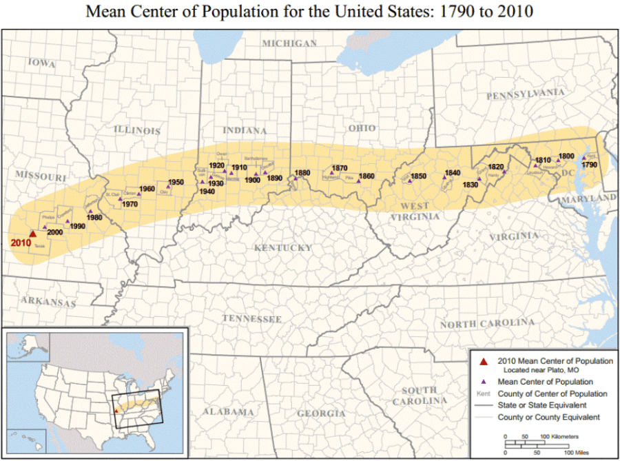
If each American had the same "weight", the mean center of the US population would be the point where, if split down the middle, the two halves would perfectly balance out. As we can see, the lure of the western "frontier" has really stuck.
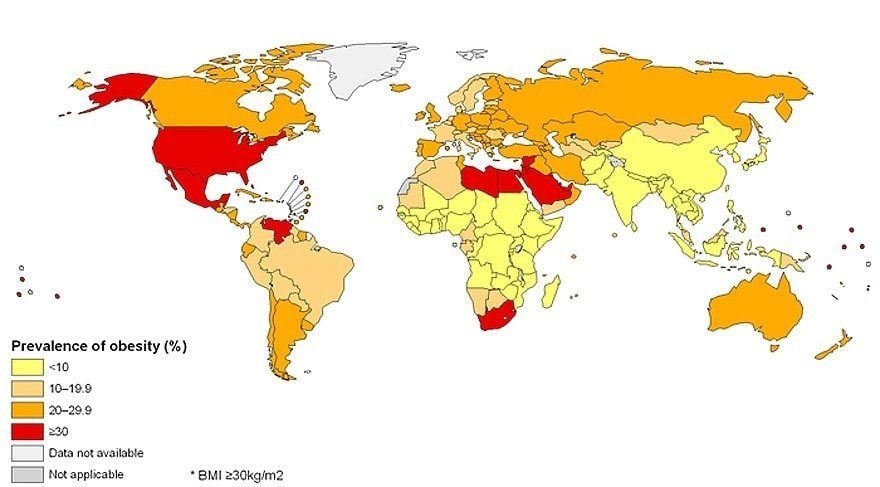
Global Obesity Rates
Among developed countries, the United States has the highest rate of obesity, with one-third of the population classified as obese. This rate is estimated by the Harvard School of Public Health to reach 50% by 2030.
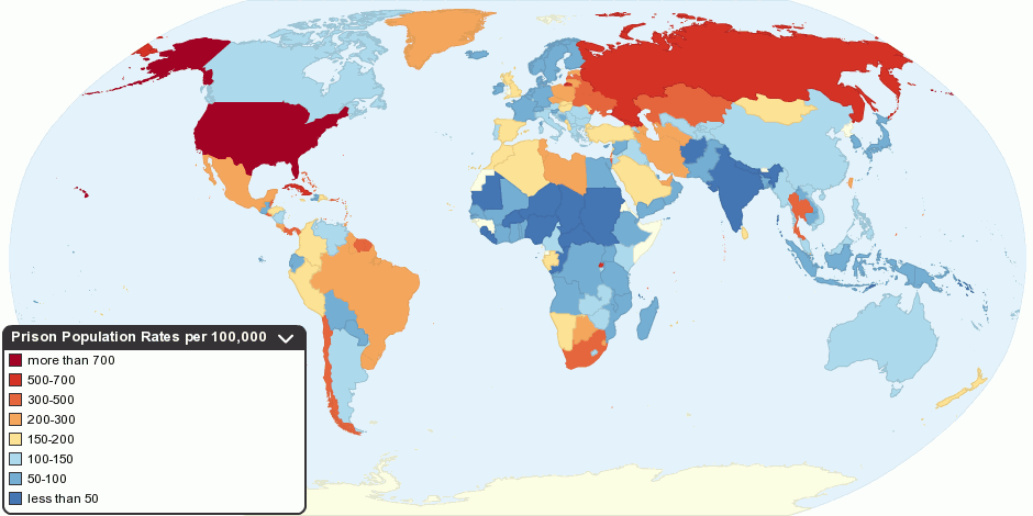
Global Incarceration Rates
As of 2014, the United States has the highest incarceration rate on the planet. While America represents 4.4% of the world's population, it houses 22% of the world's prisoners.
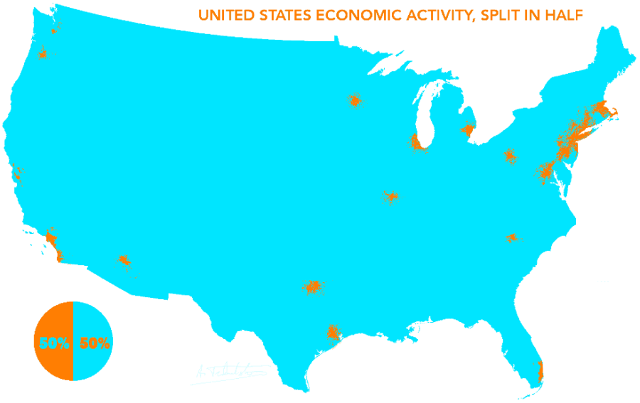
In many respects, the United States is the tale of two countries. Not only is money increasingly concentrated in the hands of fewer people, but also in fewer areas of the United States.
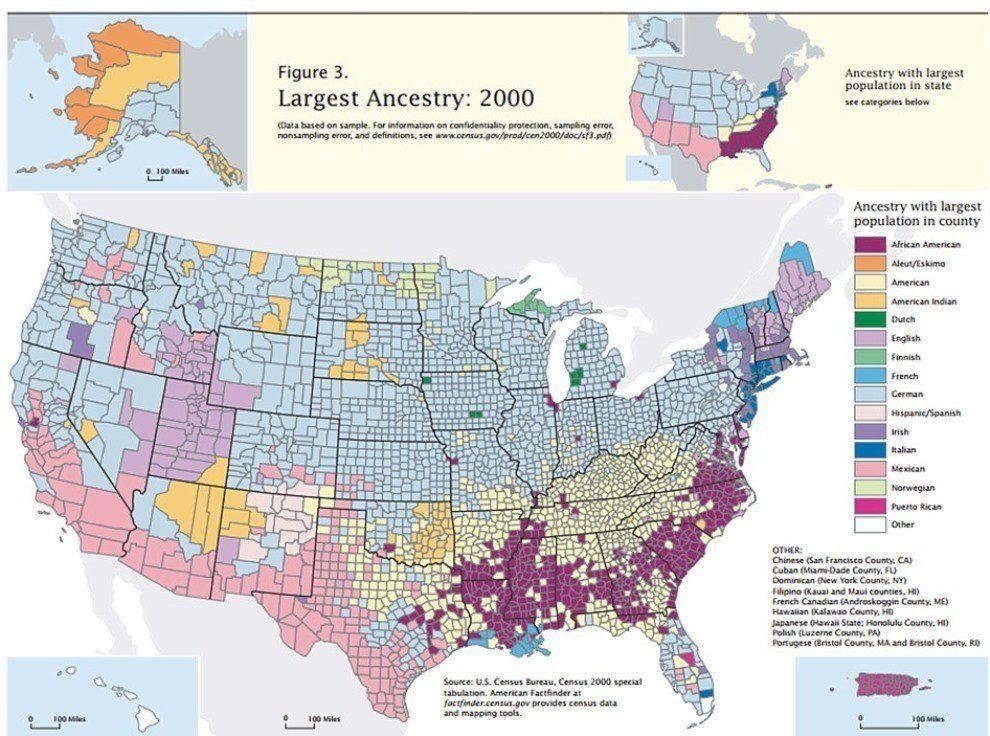
The Largest Ancestry By County In The United States
The legacy of conquest and opportunity-seeking can be found in our blood--and on our maps. African and African American ancestry is most common in the once slave-holding South, just as Mexican heritage in Texas transcends annexation and war.
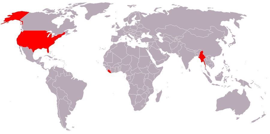
Countries That Use The Imperial System
As of 2015, only three countries continue to eschew the metric system in favor of the Imperial system: Burma, Liberia, and the United States.
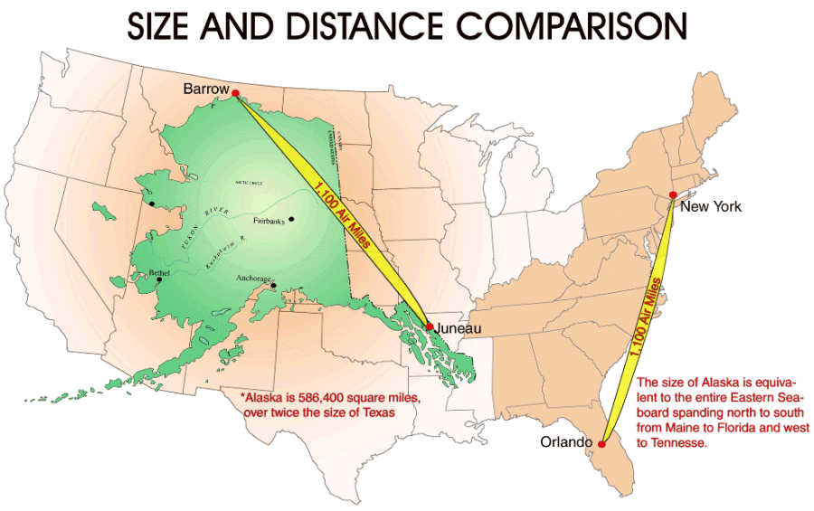
In the standard Mercator projection map, Alaska is shown to be comparable to Texas in terms of size. In reality, it's actually twice the size of Texas and roughly 25% the overall size of the continental United States.
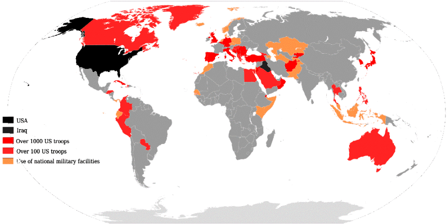
Deployment Of American Troops By Country
A consistent source of global tension, 230,000 members of the United States military are deployed in over 160 countries across the world.
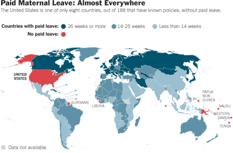
The United States joins Suriname, Liberia and a handful of other countries that decline to provide paid maternity leave. Meanwhile, access to affordable contraception and family planning services has become the subject of intense political debate.
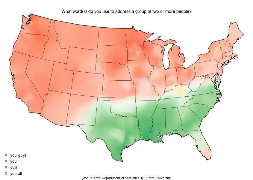
"Y'all" is one of the most common linguistic markers of Southern heritage, but its origins actually come from across the pond. Scots-Irish immigrants brought the phrase "Ye aw" with them to the South, and the rest, they say, is history.
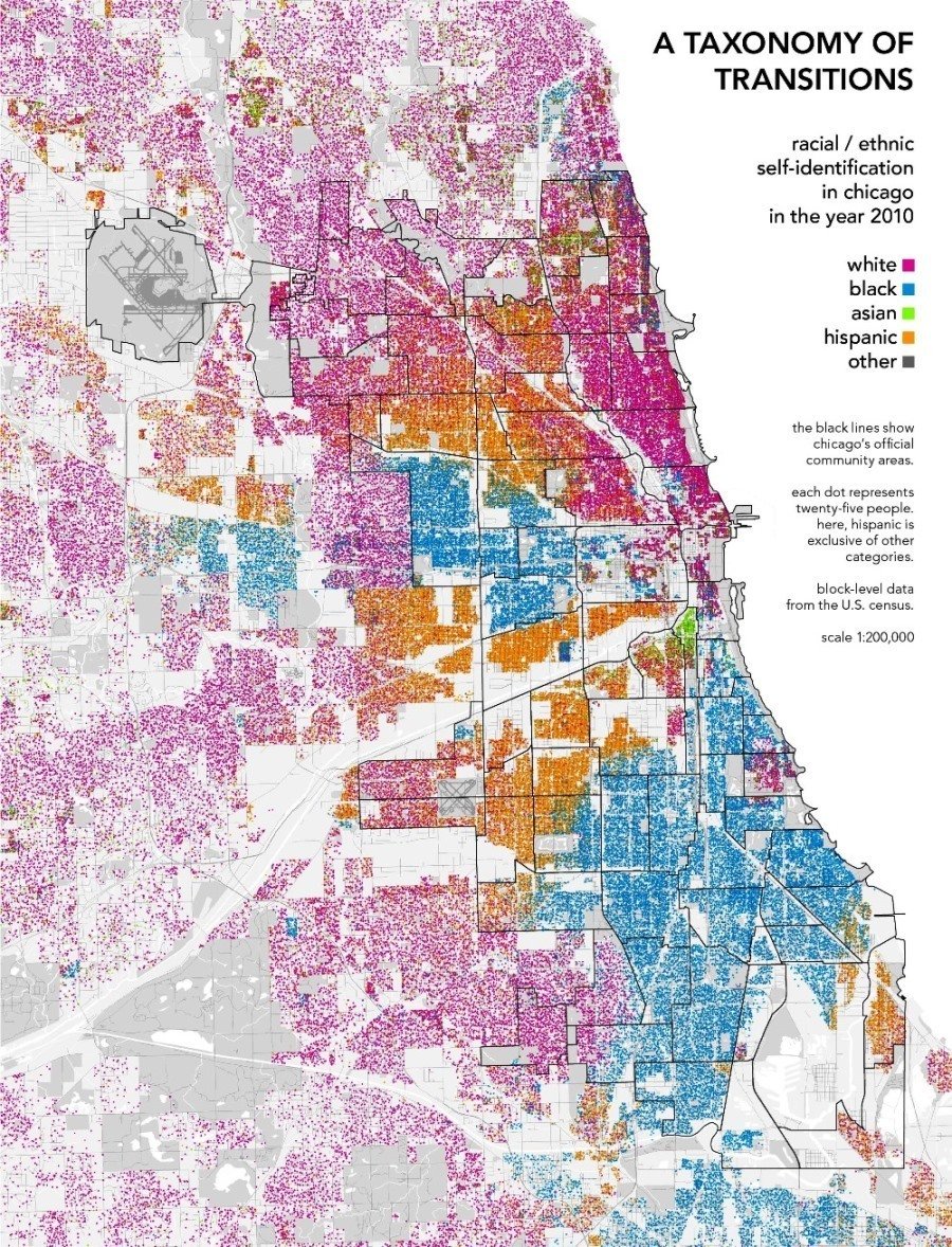
Racial Segregation In Chicago
While government-mandated racial segregation ended in the 1960s, de facto residential segregation has sprung up in its wake. The above map of Chicago's white, black, Asian and Latino populations visualizes just how insulated groups continue to be from each other.
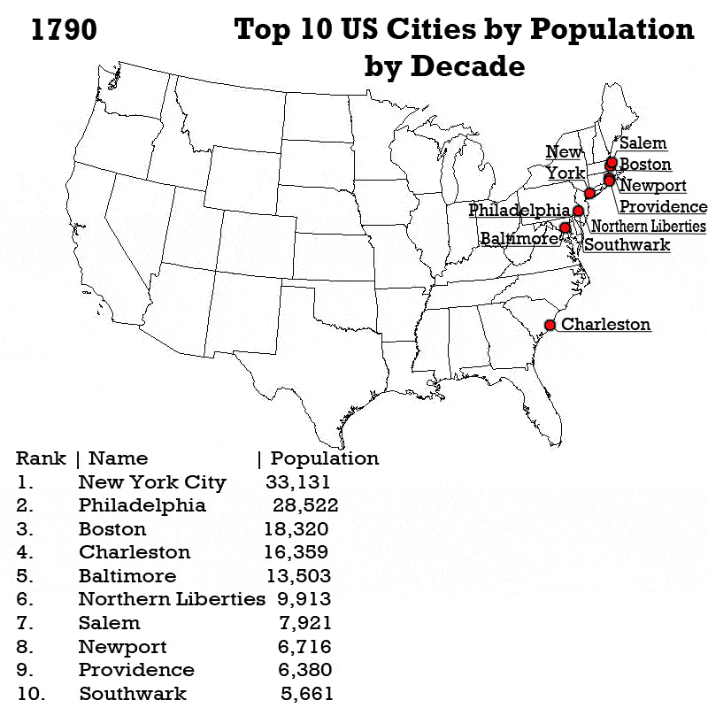
Blame it on the European countries who just couldn't give up their colonies. It wasn't until the mid 20th century that American cities out West really took off.
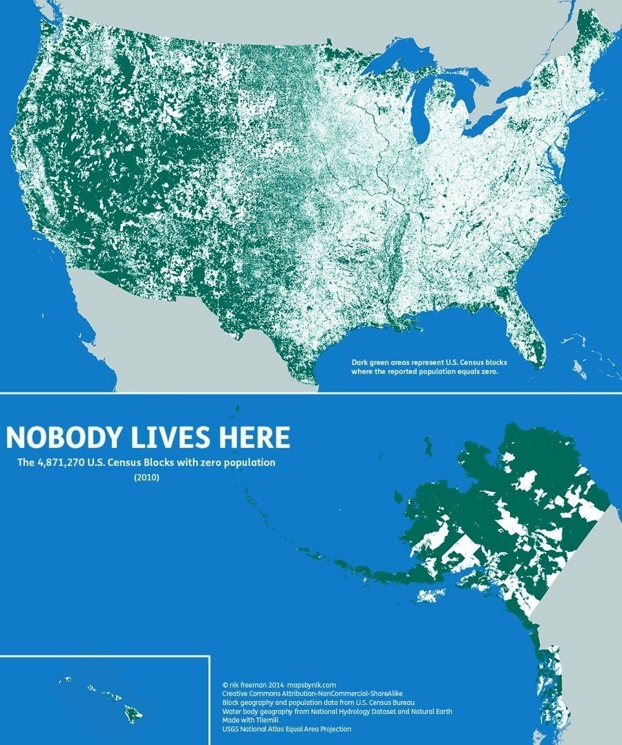
United States Census Blocks With No Populations
While the green tones collecting in the Western half of the US might inspire a misanthrope to make a move to Utah, beware: most of the uninhabited areas in this map are only that way due to natural features that make it difficult to live there or because human settlement is prohibited there (think national parks).
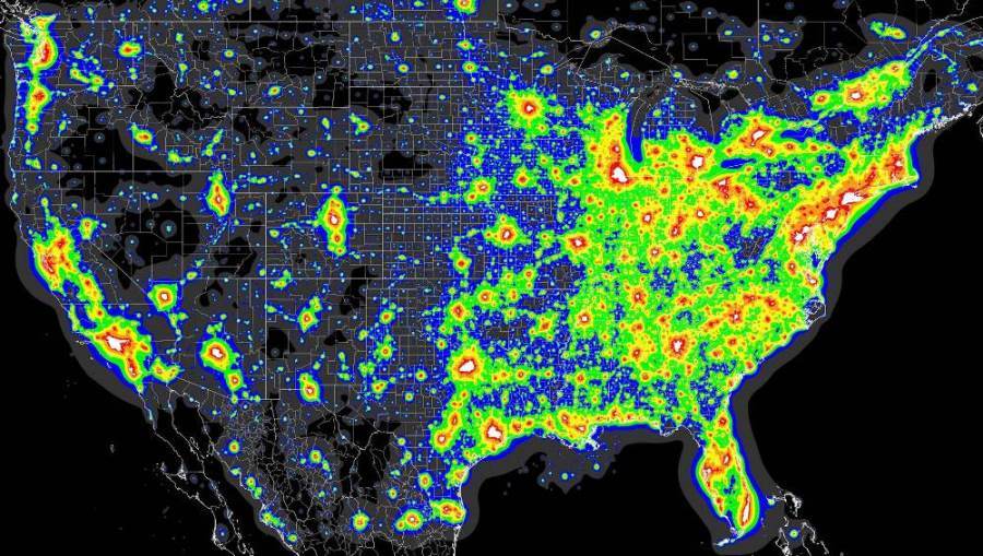
A Map Of Light Pollution In The United States
The east coast of America suffers from some of the worst light pollution in the planet, depicted in the heat map above of light pollution in the continental US.
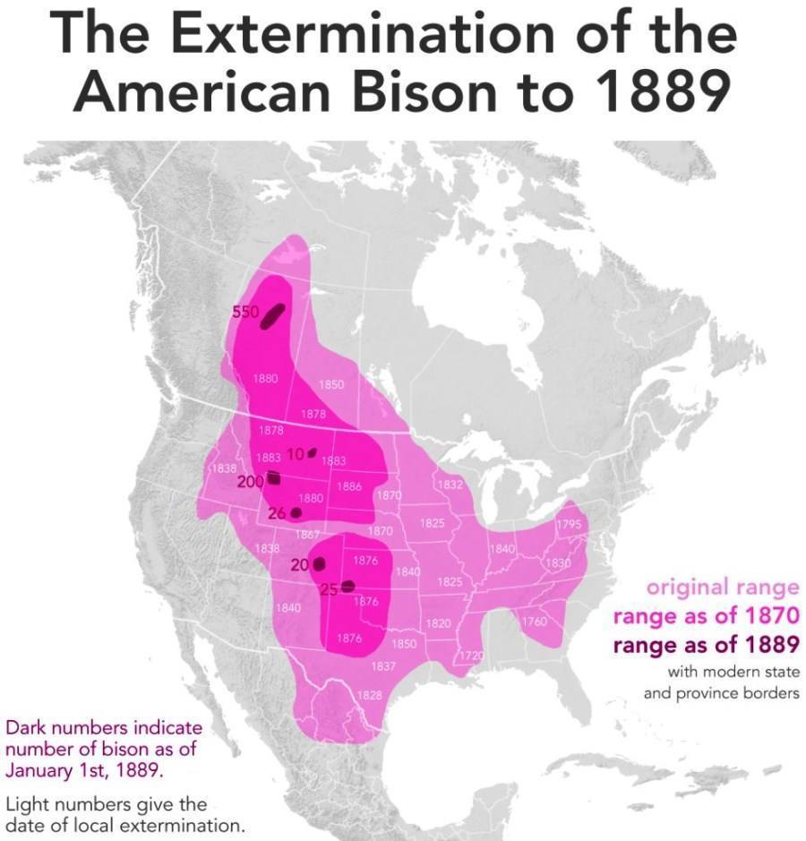
Once numbering in the hundreds of millions in North America, the American Bison were slaughtered in the 1800s for their fur and meat during the westward expansion of the United States. Bison populations were pushed to the point of near-extinction with only 1,000 left in the 1890s, but were saved by an aggressive conservation program put in place by Theodore Roosevelt. Read about the near-extinction of American Bison on All That Is Interesting.
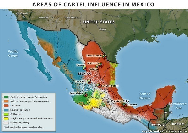
There are a number of reasons why drug cartels have gained such influence over the Mexican state and the United States never-ending War on Drugs is one of them. Mexico is a major US heroin supplier as well as the largest foreign supplier of methamphetamine and marijuana. In fact, production of these drugs has only increased since Mexico launched its own War on Drugs in 2005. Currently, the drug trade employs approximately 500,000 people and contributes around $30 billion a year to the Mexican economy.
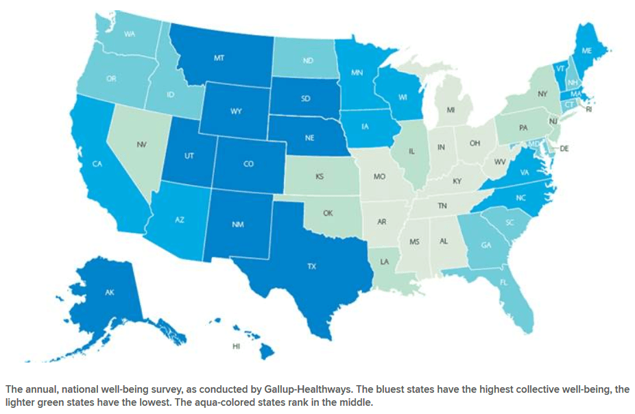
The Happiest States In The United States
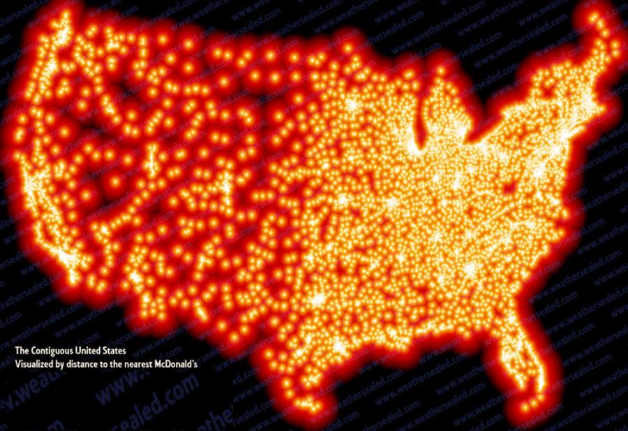
America Visualized By Distance To The Nearest McDonald's
In many ways, McDonald's has become the face of America both home and abroad. Domestically, one can hardly drive without encountering one of the 14,000 McDonald's located in America, visualized clearly by the map above.
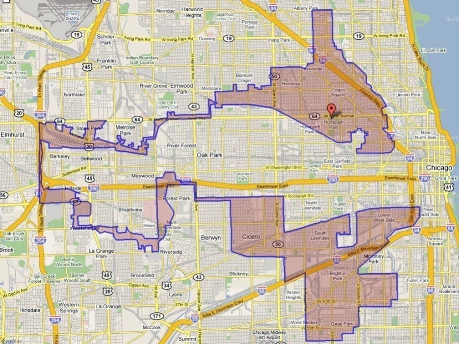
The Fourth Congressional District Of Illinois
Gerrymandering -- the practice of manipulating boundaries of political representation to favor one party has become a country-wide problem. The Economist calls Illinois’ Fourth Congressional District one of the most strangely drawn gerrymandered districts in the country. Crammed into these two tiny swaths of land are a vast amount of left-leaning Latinos, which effectively ensures that they will only have one representative in Congress and consequently cannot sway other races in the city.
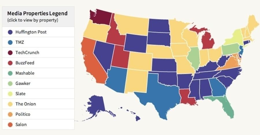
The Most Popular Website By State
Regional differences don't only mean culinary and linguistic distinctions, but also differences in media consumption, in part due to local employment sectors. The tech-heavy northwest prefers TechCrunch while the states surrounding Washington DC favors Politico.
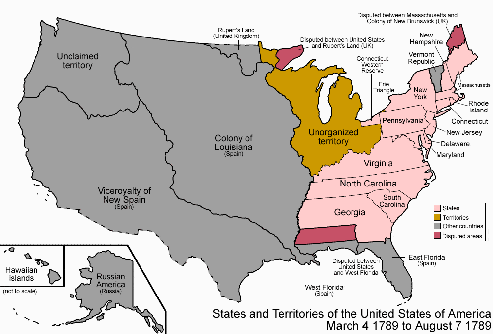
The Formation Of The United States
The United States is a relatively new country, only formed after hundreds of years of usurpation of Native American lands and purchase of territories from foreign powers. In fact, the current iteration of 50 states has only existed since Hawaii was added as a state in 1959.
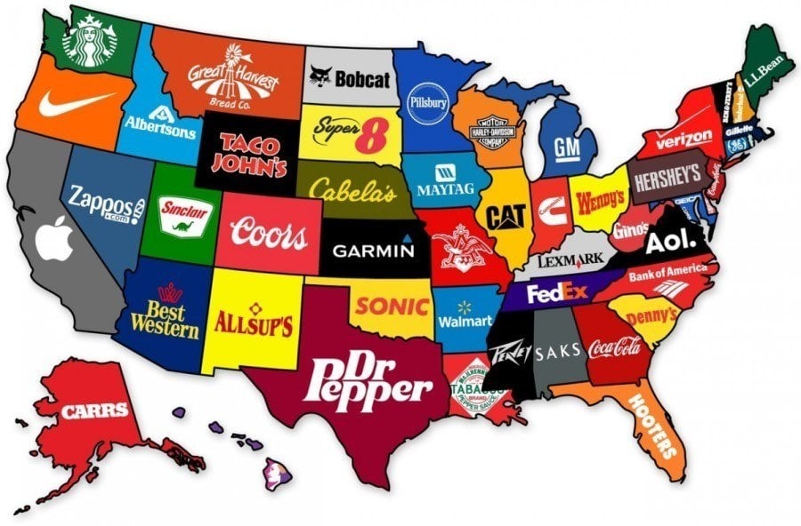
The Most Recognizable Brand From Every State
Florida, we're looking at you.
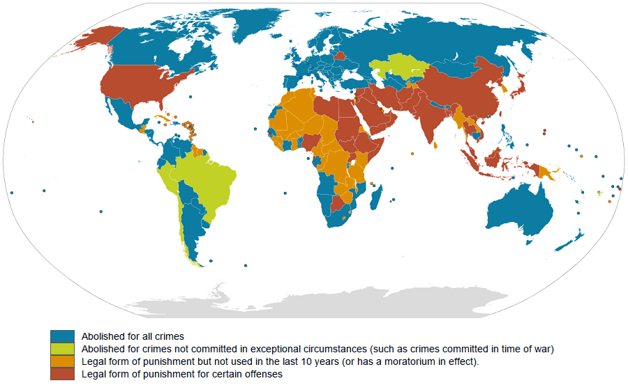
Death Penalty Practices Across The World
The United States is currently the only developed nation that still practices the death penalty. In 2008, it joined China, Iran, and 43 other countries in voting against a United Nations resolution against the death penalty.
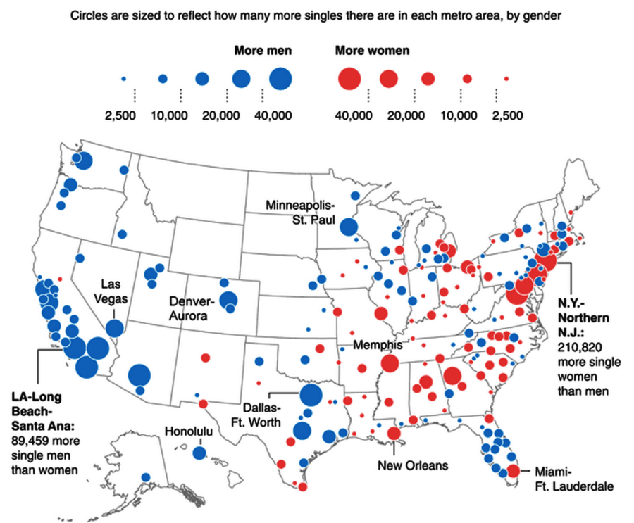
The Gender Imbalance Of Singles Across American Cities
If you're a woman looking for love, it might behoove you to head west.
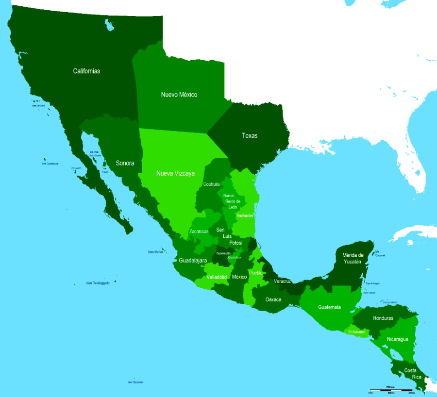
The Height Of The Mexican Empire In 1823
From 1821 to 1848 California, Texas and New Mexico formed three provinces of the Mexican Empire.
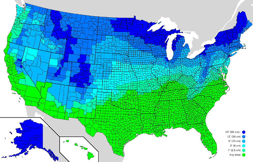
The Amount Of Snow It Takes To Cancel School By County
The United States is one of the most geographically and topographically diverse countries on Earth. Case in point: temperatures have hovered around -50 degrees in Alaska on the same day that temperatures top 130 degrees in Death Valley.
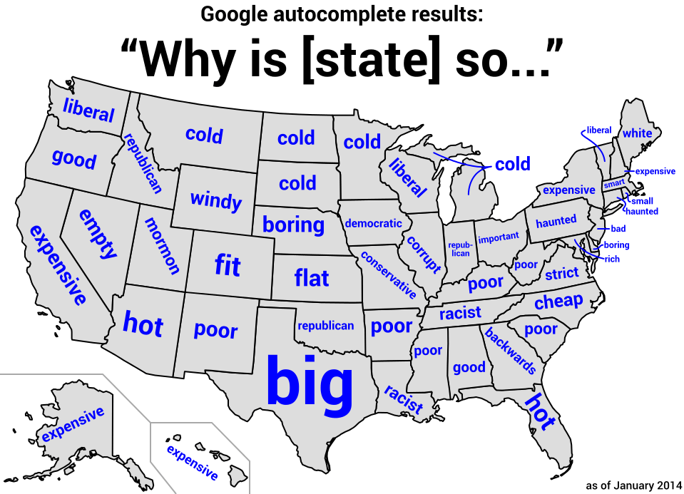
We can trace the US story through stereotypes: in the South, many wonder why states are so poor, racist and backwards, and why the Northeast is such a white, liberal enclave.
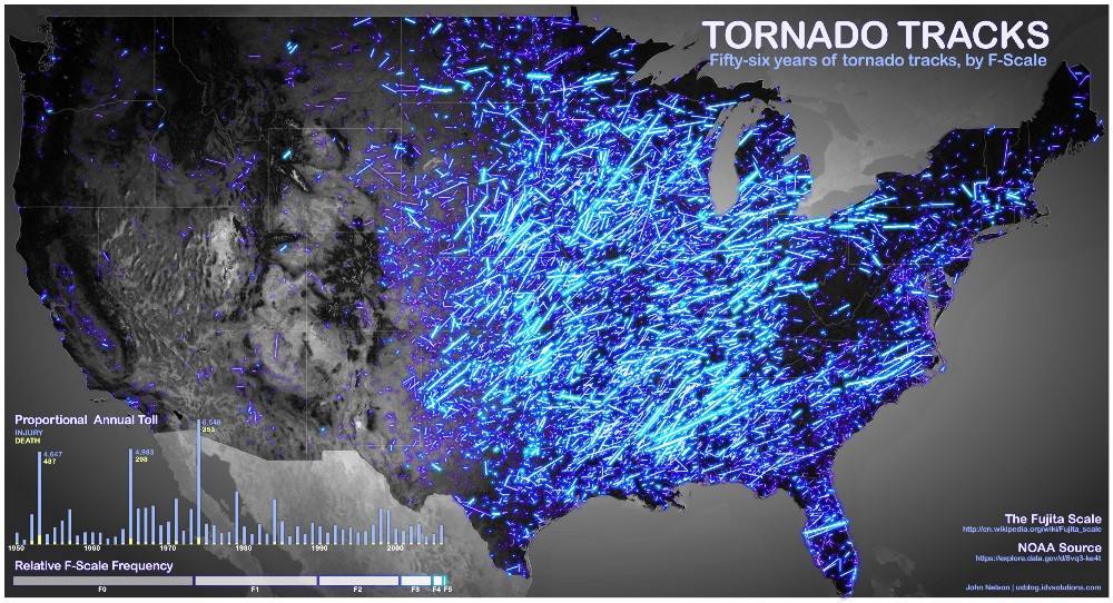
Fifty-Six Years Of Tornadoes Mapped
Known as Tornado Alley, the American Midwest is home to the highest frequency of tornadoes in the world.
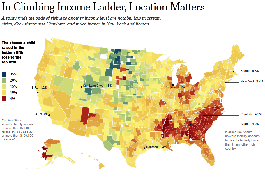
The Probability Of Upward Mobility In America By Locality
If you want your child to have a shot at entering a higher tier of the socioeconomic echelon, you might not want to settle down in the South, where segregation both class and race tends to shape your future.
If you enjoyed our collection of maps of America, check out All That Is Interesting's other posts on twenty-five maps that make sense of the world and interesting facts that will blow your mind. And if you enjoy our content, be sure to like All That's Interesting on Facebook and follow us on Instagram!